
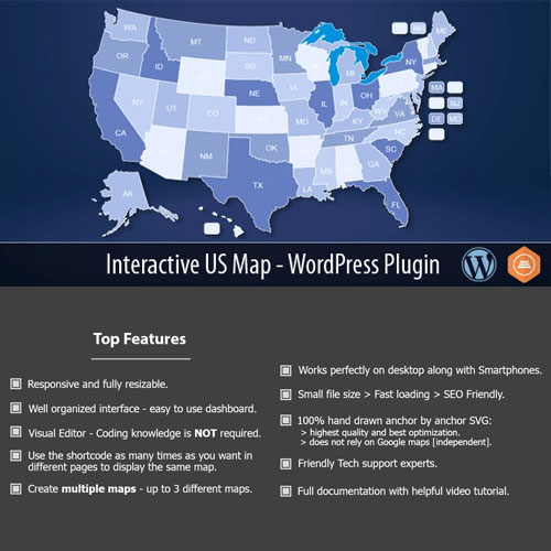


What is Interactive US Map – WordPress Plugin?
Interactive US Map is a premium WordPress plugin that provides a clickable map of the United States, designed to enhance location-based navigation on websites. This plugin allows users to configure each state with custom links, tooltips, and color-coding, making it a valuable tool for businesses or organizations that require geographic representation. Key features include individual state configuration with custom links, tooltip popups that can include HTML content, and responsive design that ensures usability across all devices. The target audience includes businesses with multi-location services, real estate websites, and educational institutions. It is compatible with most WordPress themes and frameworks, making it a versatile addition to any site. Available at MyCodeLive with GPL license, instant download, and lifetime updates.
Key Features
Clickable States
Individual state links with custom URL destinations
Tooltips
Popup information with custom HTML content per state
Color Coding
Visual data representation through state coloring
Responsive
Mobile-friendly map that adapts to screen sizes
Map Styles
Multiple visual styles and color scheme options
Who is this for?
Pros
- Individual state configuration with custom links
- Tooltip popups with custom HTML content
- Color-coded states for data visualization
- Responsive design for all screen sizes
- Multiple map styles and color options
Cons
- •Limited to United States map only
- •Manual configuration required for each state
- •Not suitable for international or world map needs
Product Description
Interactive US Map creates a clickable, responsive map of the United States for WordPress websites. Each state is individually configurable with custom links, tooltip content, colors, and click actions, making it useful for location-based navigation and data presentation.
Map Features
- Clickable individual states with custom URLs
- Tooltip popups with custom HTML content
- Color-coded states for data visualization
- Responsive design for mobile devices
- Multiple map styles and color schemes
Use Cases
The plugin serves various purposes from store locators and franchise maps to sales territory displays and regional content navigation. The visual map format makes geographic data immediately intuitive for website visitors.




Reviews
There are no reviews yet.